Content Warning

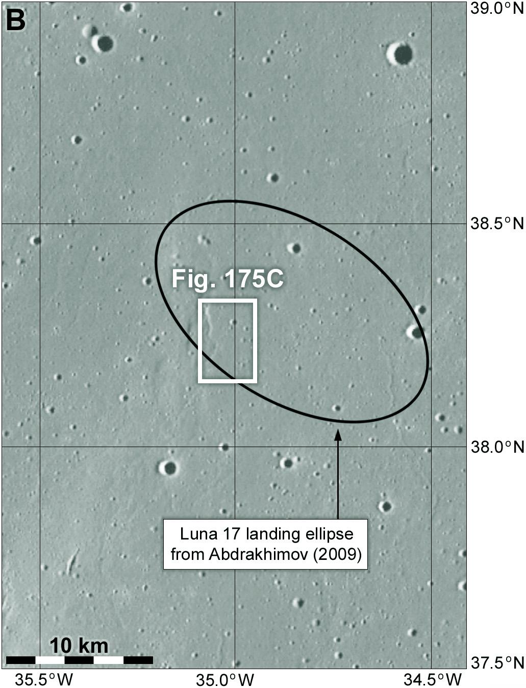
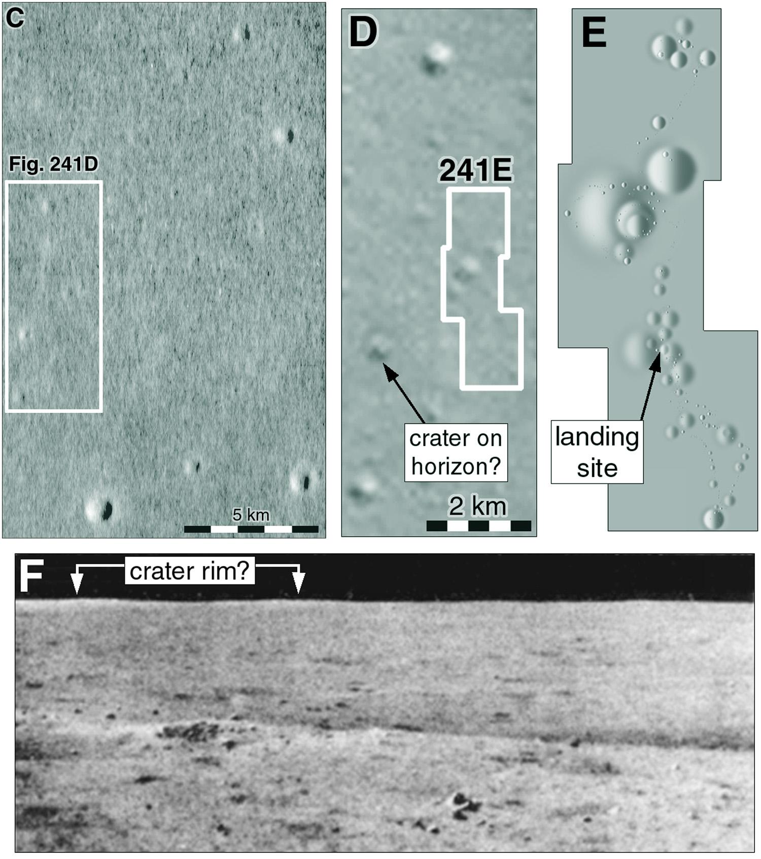
My last map has a box labelled 'Fig. 175B'. Just a reminder that these are placeholders for figure numbers in a future project which I will be talking about later in the year.

Let's zoom in on that boxed area. This map shows the landing ellipse shown in a 2009 publication. A smaller box zooms in towards the landing site. A wrinkle ridge is just visible within it.

#maps #moon #luna17 #lunokhod1

Content Warning

Finally that zoom-in sequence leads to this. Box A in the previous post refers to A here, which takes us to B with the lander itself. Box C in the previous post refers to box C here and the link to D, the rover's final parking place. Tracks from Lunokhod's wheels are visible around Luna 17 and the parked rover. We will be following the traverse in a set of maps like the Apollo EVA maps. But first, let's consider how we know where Luna 17 landed. #maps #moon#Luna17#Lunokhod1

Content Warning

Zooming in again we see the ridge very clearly. I will have something to say about it soon. Among the scattered craters are two more boxes. The lower one shows the position of the lander. The upper one shows the final resting place of the rover. I make sequences of maps like these so people can easily find a small spacecraft in a large image (LRO NAC images are 50,000 pixels long and 5000 pixels wide, that's a lot of pixels to search through).
#maps #moon #luna17 #lunokhod1

Content Warning

Now it's very clear where Luna 17 landed. we have LRO images good enough to show the lander and rover and the wheel tracks. But what did we know before LRO? My first Moon atlas came out before LRO (so it was swiftly rendered out of date and some of my speculation was shown to be wrong). This illustration shows what I thought about the landing site in about 2005 when I was doing that work. Tracking and orbit data gave us a position accurate to within about 10 km. #maps #moon#Luna17 #lunokhod1